

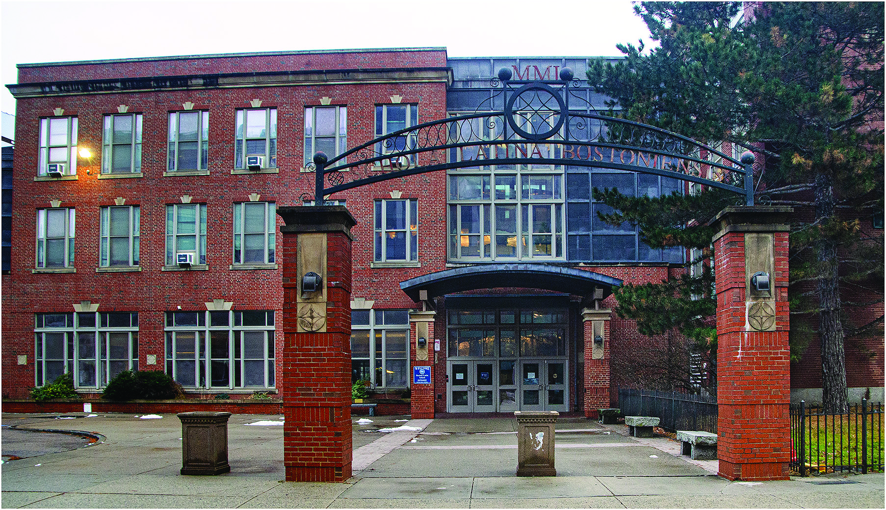
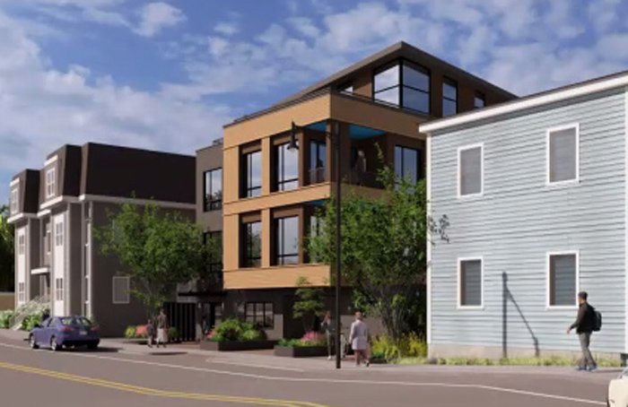
A soon-to-be-published federal study that outlines major projects meant to protect Boston from rising seas and coastal flooding during storms includes a network of levees, raised roads, and elevated Harborwalk sections along Dorchester’s waterfront as part of a larger plan for five city neighborhoods.
The draft of a Boston Coastal Storm Risk Management Feasibility Study, developed by the US Army Corps of Engineers in partnership with the city, lays out more than 20 projects along 16 miles of Boston coastline. The projects are intended to close up 20 pathways through which storm-driven harbor water could penetrate inland neighborhoods.
Here in Dorchester, the focus is on low-lying coastal areas like Patten’s Cove and Morrissey Boulevard south to Tenean Beach and Pope John Paul II Park. More than 40 percent of Boston residents—about 284,000 people—and roughly 20,000 buildings are located in areas considered vulnerable to coastal flooding. The full study, which will be made public on Friday, also includes specific projects in South Boston, the North End and Downtown, Charlestown, and East Boston.
“Boston leads with bold action to protect our communities and our future,” Mayor Michelle Wu said in a statement on Monday announcing the draft. “The future of our city depends on the steps we take now to build resilient communities.”
Wu called the study is a key step toward unlocking federal resources for construction.
Lt. Col. David MacPhail, deputy commander of the Army Corps’ New England District, called the draft “a major milestone in our shared mission of community resilience.
“The reality is that doing nothing is not a viable option,” MacPhail said. “Without action, the costs to public safety and economic vitality from coastal flooding will only be compounded.”
Officials estimate that Boston could suffer $54 billion in flood-related losses by the end of the century if no preventive measures are taken. The baseline protection system is projected to cost roughly $10 billion, with the federal government potentially covering up to 65 percent of construction costs. City officials say the work could prevent an estimated $41 billion in damages.
Dorchester figures prominently because flooding entering through the neighborhood’s low-lying waterfront could travel well beyond the shoreline, threatening homes, roads, transit infrastructure, UMass Boston, and even villages. City officials say some areas more than a mile from the coast could face severe flooding within 25 years without protective infrastructure.
Here’s a look at some key sections included in the draft, according to city officials who have seen it:
• At Patten’s Cove, near UMass Boston and Morrissey Boulevard, the Army Corps proposes a roughly six-foot-high levee along the waterfront. The land would slope upward toward a raised Harborwalk, with an accessible path intended to preserve public access and harbor views.
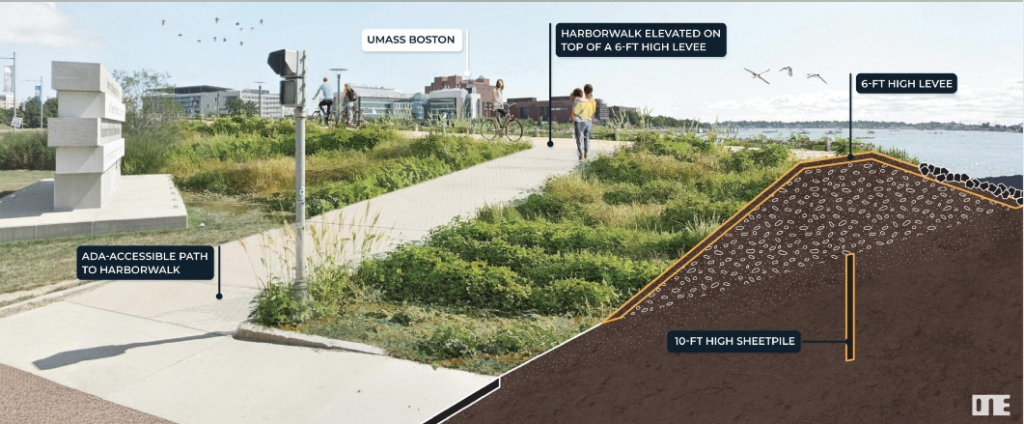
A rendering shared with The Reporter shows a barrier reinforced by a 10-foot sheet-pile wall extending below the surface. The Harborwalk would sit near the top of the levee rather than behind a conventional vertical concrete wall.
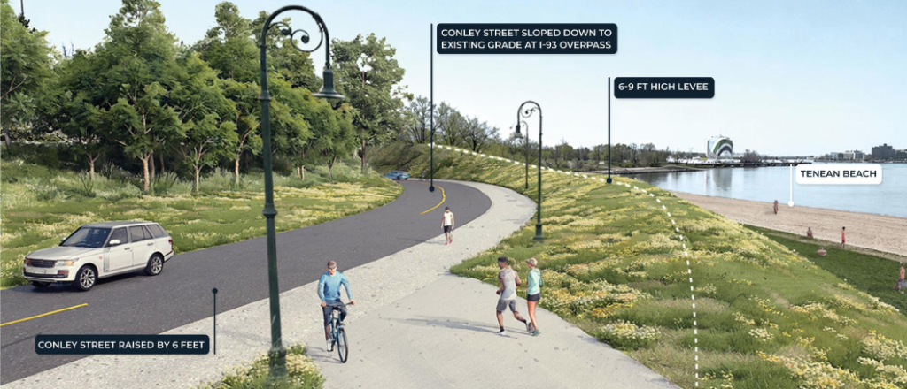
At Tenean Beach, a levee ranging from six to nine feet high would be installed along Conley Street, which would be raised by approximately six feet to form part of a continuous flood barrier. The street would gradually slope back down to its present elevation near the Southeast Expressway overpass, a design intended to maintain vehicle clearance beneath the highway.
At Pope John Paul II Park, the proposal calls for a levee approximately three to six feet high along the existing Harborwalk. The path would be reconstructed on top of the levee with existing pavilions relocated, maintaining waterfront access while creating a barrier against storm surge entering the park and nearby neighborhoods.
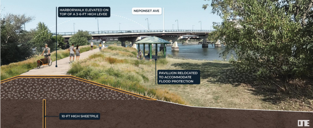
Rather than relying on exposed concrete floodwalls, the concepts generally use landscaped earthen levees, raised paths, and sloping parkland designed to make the structures less intrusive during normal conditions.
City officials caution that the Army Corps is proposing only the basic infrastructure needed to stop flooding, such as levees, seawalls, and flood barriers. Those elements should be viewed as the “base” of the future projects, not as complete designs, say planners involved in the draft report.
Additional features—including parks, seating areas, landscaping, boardwalks, recreational spaces, and improved Harborwalk connections—could later be added as “betterments.” The images released with this week’s draft are conceptual illustrations and are not final designs, they said.
None of the individual projects carry individual cost estimates at this point. The Army Corps’ $10 billion figure covers baseline flood infrastructure citywide.
The city and the Army Corps are expected to seek community feedback through a website posted this week. Residents are asked to weigh in with comments through Sept. 18. The final study is scheduled to be completed in 2028.
