

Last week, while leaders of countries from every corner of the globe were gathering near Paris for the 2015 United Nations Climate Change Conference, a handful of Dorchester residents were holding a climate change conference of their own. At the monthly meeting of the Columbia-Savin Hill Civic Association, guest speaker Rebecca Herst, climate project manager for The Boston Harbor Association (TBHA), stood before the group and asked if anyone knew how high the sea level was predicted to rise in Boston Harbor by the end of the century. Since nobody in attendance claimed to know, she gave the answer: up to six feet.
Herst explained how the extremities of the once-in-a-hundred-year flood will eventually become twice daily high tides. If you want to crunch the numbers for yourself, just review the data on the “Mean Sea Level Trend” chart posted on the official website of the city of Boston, cityofboston.gov. It looks like the 10-inch increase of the last century will double by 2040, and continue increasing exponentially until 2100 and beyond. Here is an excerpt from the text:
“Over the past century, the relative sea level has risen about 10 inches. Scientists estimate that about half of this is from a rise in the absolute sea level, and half from land subsidence. Recent data suggest that the rate of sea-level rise is increasing. Projections of sea-level rise for Boston range from 2 feet to as much as 6 feet by the end of the century, depending on how fast ice in Greenland and Antarctica melt.”
When it comes to talk of global warming, a lot of people default to avoidance reflexes and plug their ears. But Herst put a face on the problem – a young face – and people in the room sat up and listened when they began to realize that there might be something they can do to help the next generation. She represents an initiative to connect policy makers with property owners and coastal community groups in the quest for maximum climate change adaptation. She is getting the word out that ordinary people are needed at the planning table to provide vital information, to contribute ideas, and to help build community resiliency.
The discussion later drifted to a topic that brought on another round of hand-wringing: flood insurance. In 2013, the Federal Emergency Management Authority (FEMA) released maps designating coastal flood zones. Those with mortgages on property situated on the flood plain are required by federal law to acquire flood insurance. The FEMA maps produced an outcry from alarmed home-owners, and pushback from cities and towns that are appealing the designations. As a consequence, the maps have been revised, but hardly diminished as the standard for insurance rating.
At the CSHCA meeting, people wanted to know how they could ascertain if and when they would be liable. It turns out that FEMA won’t be sending out notifications; it’s up to property owners to get the FEMA map and find out for themselves – or they can wait until their mortgage companies send them a bill. Judging by the response in the room, several individuals were hearing this for the first time.
There were questions about the FEMA maps because common sense says that it is impossible to specify a single height for land elevation in extended areas, especially in hilly Dorchester, where a house at one end of the street might be considerably higher than a house at the other end. At this point in the discussion, answers were hard to come by.
Other communities are also going through this. Confronted with flood insurance policies costing anywhere from $2,000 to $20,000, many people who found themselves in a high-risk hazard area have challenged their FEMA ratings. They were able to pull themselves out of the flood zone by hiring engineers to conduct an independent assessment and issue elevation certificates that successfully countered FEMA designations.
Although Boston’s official elevation is 46 feet above sea level, the relative risk is enhanced by the fact that 50 percent of the city is built on landfill in former wetlands. If the ocean wants it all back, there is nothing to be done except to prepare for a “managed retreat.” TBHA is collecting data on hazards and exposure, and creating scenarios of potential outcomes.
The 2015 Boston Living with Water International Design Competition generated several innovative proposals that would make way for the encroaching water. One proposal envisions Boston’s downtown streets being transformed into a network of canals with intersecting sidewalks raised to second-story elevation. This might be an option around the Seaport District, where recently there has been significant infrastructure investment and state-of-the-art real estate construction; but what about Dorchester?
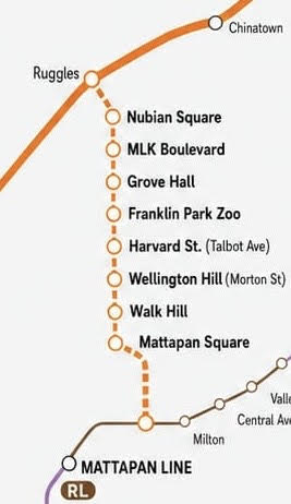
With flat roofs, a multitude of double-hung windows, and service utilities located in the basement, Dorchester’s tightly packed wooden houses are susceptible to damage from flooding, heat waves, and storms. We live in an urban area with the type of high-density development that exacerbates the effects of extreme heat events, with the potential to create “heat islands” that result in additional stresses. Most vulnerable are the elderly, young children, and low-income residents. There’s also the question of how the Red Line will be affected by these extreme weather patterns?
Rising water and increased storm related flooding are going to force hard decisions on how to equitably manage flood areas. Working to find solutions for this crisis will vitalize incentives to overcome other challenges that plague society. But who is going to pay for it? Supposing that everyone is expected to shoulder a share of the burden, we might reasonably hope to benefit from a sort of waterlogged egalitarianism, where every citizen is valued alike in the struggle against a common threat.
Education, collaborative planning, and fair assessments are essential. Investing in sustainable living does not cost extra; it is a diversion of funds from fossil fuels to better methods. Think of all the jobs that this would create. Ms. Herst’s message is simple: It’s harder to change for the better if you do not have a path set down for how to change.
•••
FEMA and city officials will host an informational meeting for the public on Jan. 12 from 4 p.m. to 7 p.m. at the Boston Teachers Union Hall at 180 Mt. Vernon Street on Columbia Point.
